columbisriver2017
Overnight we continued west to The Dalles, Oregon. This is the Dalles Bridge just west of the locks of The Dalles dam.

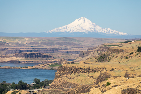
We docked in The Dalles and then took a bus to Maryhill Museum. We stopped prior to the Museum at a reconstructed Stonehenge created by Samuel Hill. Mr. Hill also built a mansion which is now the Meryhill Museum.
columbisriver2017
Virginia Ann and Cal with Mount Hood in the background. On the left is the Columbia River.
columbisriver2017
Hells Gate Canyon on the left on the Columbia River and Mount Hood in the background
columbisriver2017
Cal taking the above picture
columbisriver2017
The government pays for the lease of land for wind turbines which is generating not only electricity but income for the Maryhill Museum.
columbisriver2017
Maryhill was (is) a town on the banks of the Columbia River. This church is the only orginial building left from the 1910 community that is named after his daughter.
columbisriver2017
A view of Mount Hood and the Columbia River with the wildflowers of eastern Oregon.
columbisriver2017
Jay, Mary, Cal, and Virginia Ann
columbisriver2017
After lunch a visit to the Columbia Gorge Discovery a very nice museum.

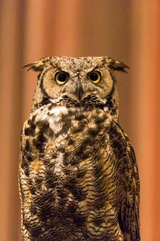
We were treated to a birds of prey show with several beautiful birds up close. This is a Great Horned Owl.
columbisriver2017
The Columbia Gorge Discovery also has two Bald Eagles. All of the birds are rescue birds and cannot be returned to the wild.
columbisriver2017
The Dalles is where Google created their first big green data center. The site was chosen as they had river water to cool the computers and cheap electricity from the nearby dam. This is a building on a site where they are building a second much larger data center.
columbisriver2017
One of the many trains seen on the trip traveling on both sides of the Columbia River.
columbisriver2017
Shoreline along the Columbia River after we left The Dalles.
columbisriver2017
An osprey with a fish flew around the S.S. Legacy
columbisriver2017
I just happened to be watching in the right direction to catch something splash into the Columbia River. I quickly brought up my camera and caught the second jumper, unfortunately they were a long way off.
columbisriver2017
The bridge of a tug high atop over the actual boat
columbisriver2017
Beacon Rock

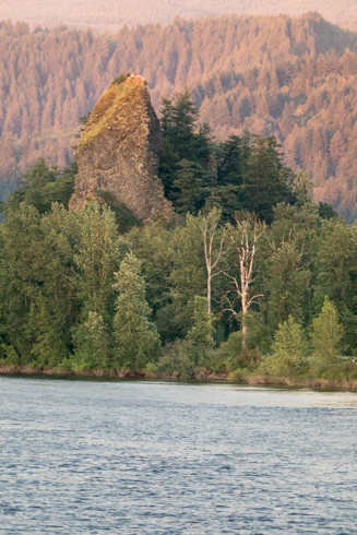
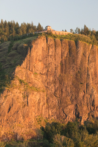
Beacon Rock is 848 feet tall and is composed of basalt. Henry Biddle purchased the rock in 1915 for $1 and during the next three years constructed a trail with 51 switchbacks, handrails and bridges. The three-quarter mile trail to the top, completed in April 1918, leads to views in all directions.
columbisriver2017
Multnomah Falls from the ship. You cannot see Benson Footbridge nor the lower falls.

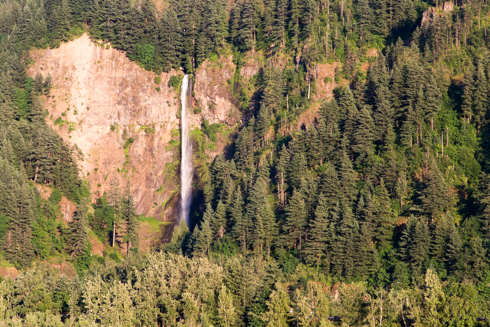
Underground springs from Larch Mountain provide a year round source of water for the waterfall, augmented by spring runoff from the mountain's snowpack and rainwater during the other seasons.
columbisriver2017
A railroad tunnel in a cliff along with a small waterfall into the Columbia River.
columbisriver2017
Sunset on Beacon Rock as it fades into the distance.
columbisriver2017
A patriotic view of the Columbia River.
columbisriver2017
The Vista House on top of Crown Point overlooking the Columbia River 773 feet below.

Opened in 1918 as a rest stop and observation point on a new highway along the Columbia River.
columbisriver2017
A huge rock along the Columbia River.
columbisriver2017
Leaving the Columbia River Gorge as the sun sets. The land on both sides of the river drops away and becomes much flatter once you are outside of the gorge.
columbisriver2017
Sunset on the Columbia River.


Top
Top