Up early the next day and out on the top deck to view the Columbia River
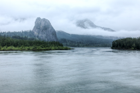
This is Beacon Rock that is very distinct on the Columbia River.
It was named by Lewis and Clark in 1805; they originally referred to it as Beaten Rock,
later as Beacon Rock. They noted that the rock marked the eastern extent of the tidal influence in the Columbia.
There was heavy cloud cover and fog near the river.
Beautiful mountainsides covered in trees all the way to the Columbia River's edge
This looks like a Blue Egret on the river's shore
The ship slowed so that we would arrive at Bonneville Locks just before breakfast. This was our first of
many lock experiences.
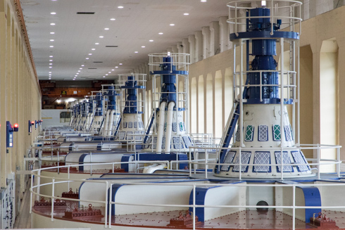
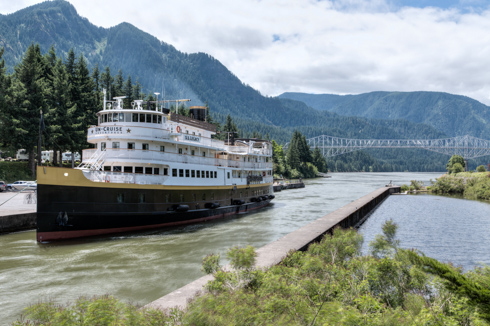
We were pretty excited about the lock experience - as the trip went on these became routine - there are
8 locks each way so 16 lock experiences total on the cruise.
Bonneville Dam was built for river control and electricity generation. We received a great tour
of the dam by the National Park Service.
Two separate fish ladders combine at the top of the dam and force the fish through a small opening
so that they may be counted.
The river water was very murky, so few salmon but these little Pacific Lampreys were holding on to the
windows that look into the top of the fish ladder.
Pacific Lampreys are parasites, while in the ocean they attach themselves to other fish and whales for food.
They migrate
like salmon up the rivers to spawn.
Cal and Mary enjoying the rose garden at the Bonneville Dam Visitors Center
A rose - beautiful gardens
A rose - oh no, that is my beautiful sister, Mary - still a rose
A rose with buds - pretty in pink
We then took a bus to Multnomah Falls a beautiful dual drop fall. A very high first fall and then a massive
second falls. The Benson Footbridge over the second falls affords a great view to the first falls.
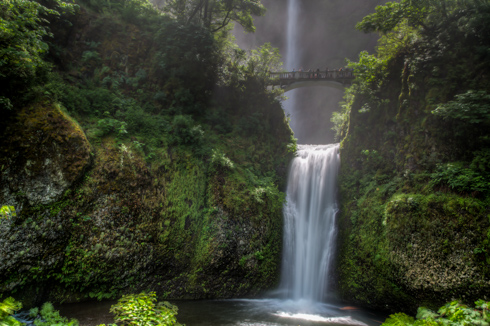
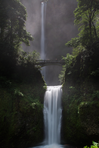
Multnomah Falls is the tallest falls in Oregon and the second tallest year round waterfall in the US.
Mary and Jay Cross on the Benson Footbridge
Bill and Liz Brooks on the Benson Footbridge
Both upper and lower Multnomah Falls
The ship S.S. Legacy in the old locks - Cascade Locks. No longer in use since the Bonneville Dam. In the
background is the Bridge of the Gods a beautiful steel truss cantilever bridge.
A barge moving downstream - there was barge traffic every day on the river.
From the bridge of the S.S. Legacy. The staff was great allowing visitors to the bridge during the cruise.
You could also tour the engine room and galley.
Hood River - a city where the Hood River enters the Columbia, was very busy with water sports. Wind surfing,
para gliding, jet skies, boats.... lots going on in the river.
Mount Hood - shrouded in clouds. We would spot it several times on our trip.
Tug boats used to move the barge traffic up and down the river.
An egret moving fast down river
The further into the Columbia Gorge the fewer trees and more rocks became visible.
Mount Hood makes an appearance later upriver.
The granite obelisk on Memaloose Island is the grave of Victor Trevitt,
a pioneer who wished to be buried with his Indian friends.
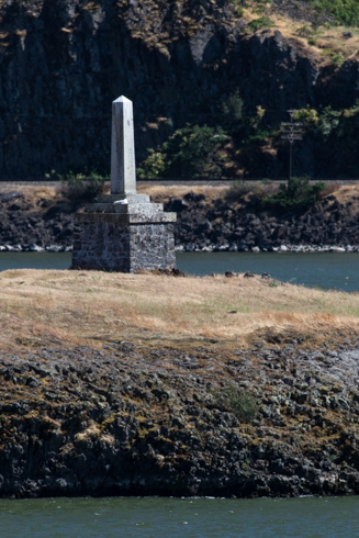
On October 29, 1805, Lewis and Clark called Memaloose Island "Sepulchar Island". It was one of several
islands commented on by Lewis and Clark as containing burial vaults for the Indian peoples that lived
along the Columbia River.
Osprey make their nests in the channel markers where they are safe and can hunt fish. Here is a nest with a
little
chick peeking out.
The various channel markers along the route contrast against the water and rocks
Sometimes the markers seemed to be painted on the rocks themselves
The terrain became more barren as the ship went east on the Columbia River
Until the landscape bore no trees - in just one day from the top of the page until now - all trees
- then trees.
Mary enjoys the breeze as the ship moves along the Columbia River.