Thursday, April 8, 2021 -
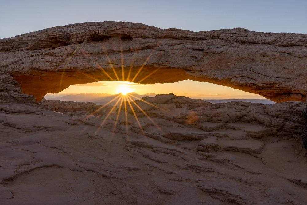
Up at 0400 for an hour drive to Mesa Arch - I had read that it would be very crowded and I needed to be at the
arch a minimum of an hour prior to sunrise. I arrived 1.5 hours prior to sunrise and there were at least 15
photographers already lined up with their tripods. I was able to get into the line and set up. While we waited
for the sun I asked how long they had been there - since 0300!!! They started the day taking pictures of the
Milky Way over the arch - the pictures I saw were beautiful so I resolved to get up early and try for the Milky
Way myself.
Here is the sun cresting the La Sal Mountains - you can just imagine all the cameras going off as the
sun was in the perfect place. Unfortunately, the number of photographers meant that we could not get very close to
the arch and see the valley below - as in my dry run picture.
Creeping up to the edge of the cliff you can see into the Colorado River Valley. The sun breaks on the La Sal
Mountains and highlights the rock formations.
The beauty of Mesa Arch is the reflection of the red rock in the rays of the sunrise. It makes the rock on the
underside of the arch glow. You can see the valley floor below several hundred feet down.
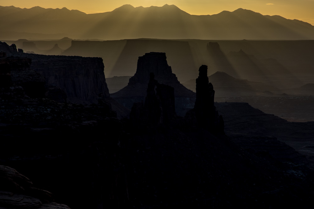
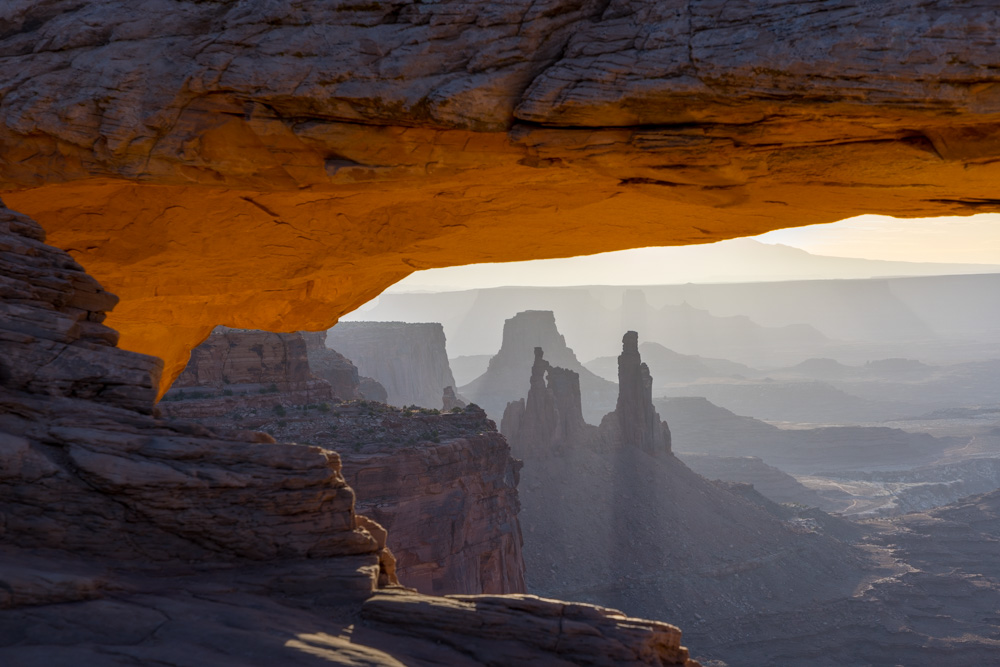
By now the photographers had largely left and you could get close to the arch for different
compositions.
The rock towers in the Colorado Valley - the one on the left is the Washer Woman as it looks like a woman
washing.
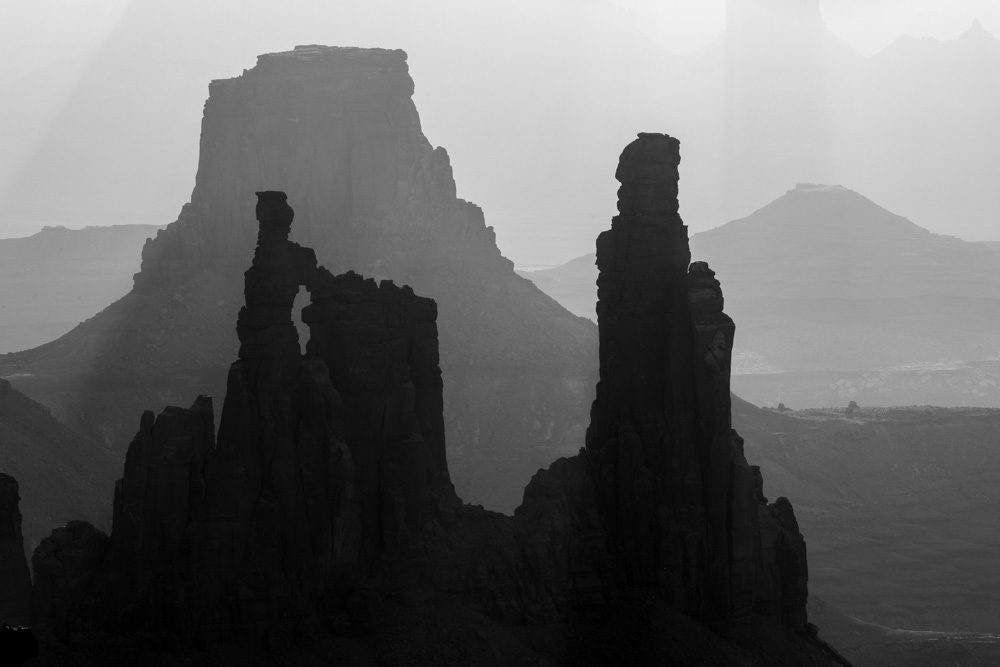
I went to black and white as the contrast with the rising sun was so great.
After Mesa Arch I drove a short way to Dead Horse Point State Park. Here the Colorado River carves a sharp turn
through the rock. The river was an old river long ago as the land around the river rose the Colorado continued to
cut its way.
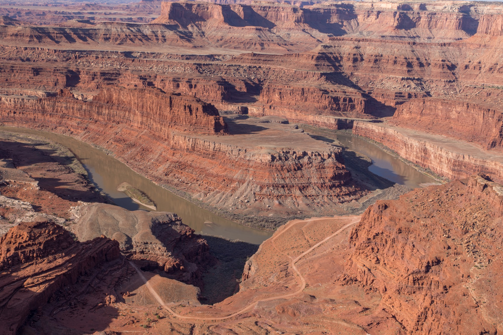
You can see a road along the river and while I was there several expeditions drove along the river.
A closeup of the Colorado River and the cliffs above the river. Only one boat came along and carefully stayed
out of visibility while I tried to get a picture of the boat maneuvering the turn.
The cliff face over the valley below. The rock texture and patters are so captivating.
A tall rock formation in the canyon - reminded me of the rock formations in the Grand Canyon. The rocks are so
beautiful.
I then traveled to the entrance to Arches National Park, and it was closed - too many people and a sign to wait
three hours and try again. So, I went to a back-up site I had researched - Corona Arch.
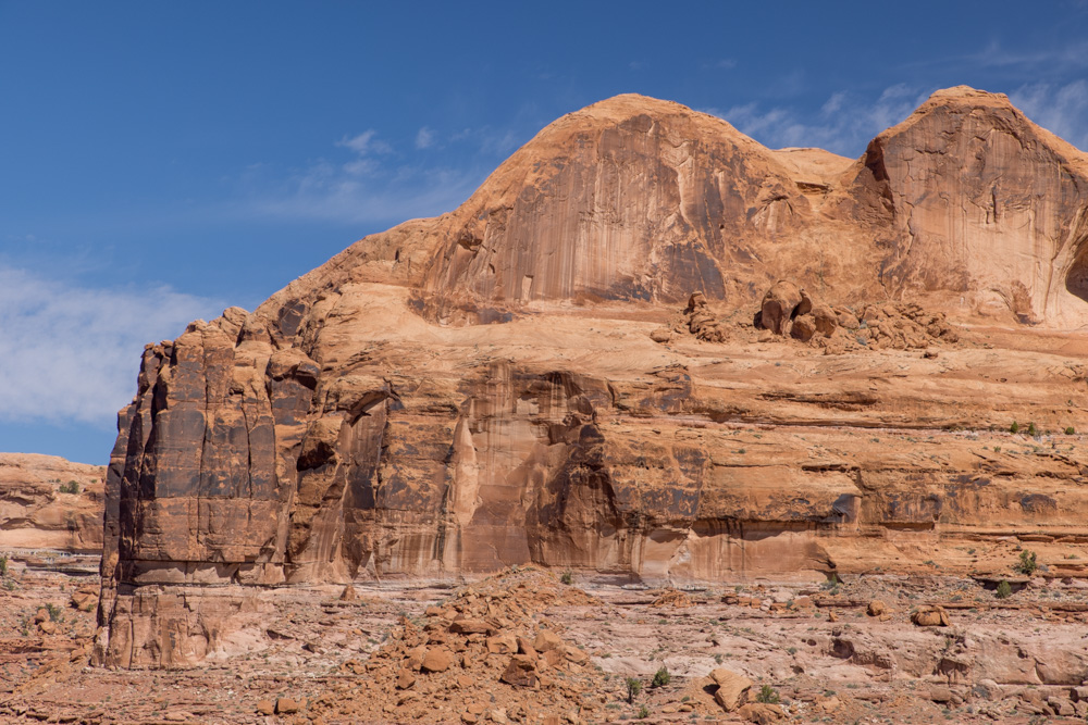
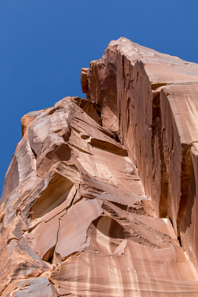
This is a scene from the trailhead to Corona Arch - a great big mesa of rock.
Very near Corona Arch is Bowtie Arch which is a pothole arch created when a pothole wears through the top of the
rock and forms a window.
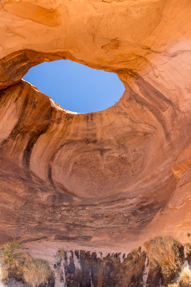
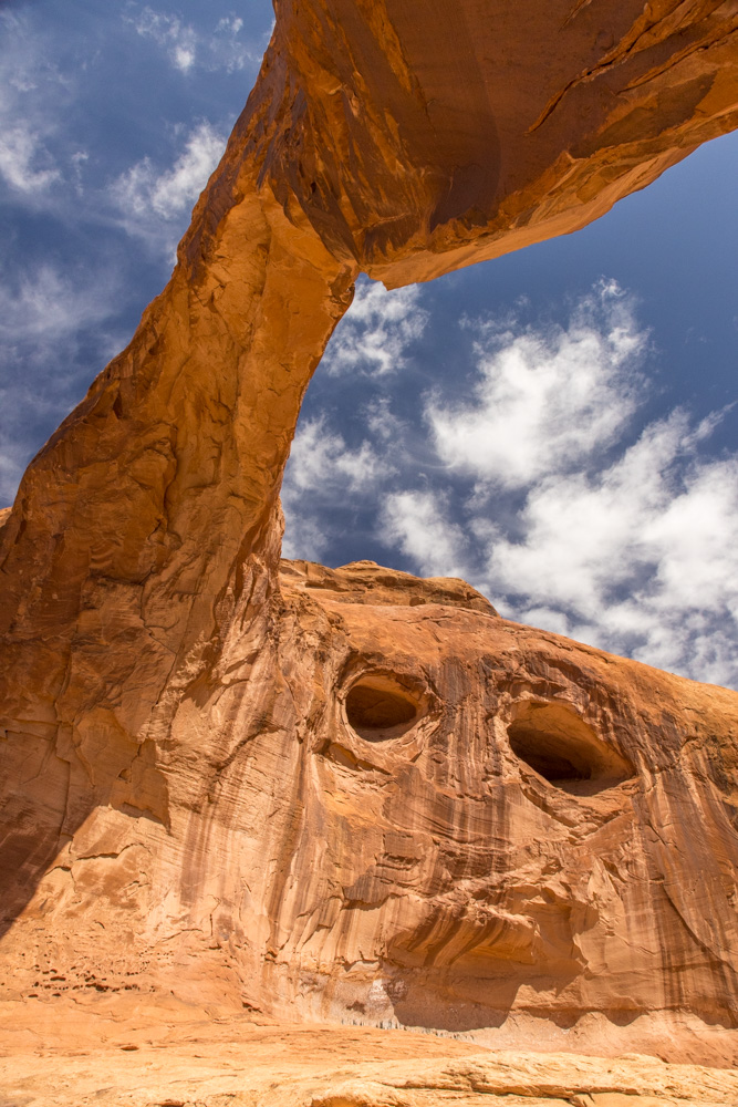
A scramble up a small cliff and you can stand below the arch - directly below. Everyone was so focused
on Corona Arch and few really enjoyed Bowtie Arch.
Corona Arch - which I think was the prettiest of the arches I visited on my time in Moab.
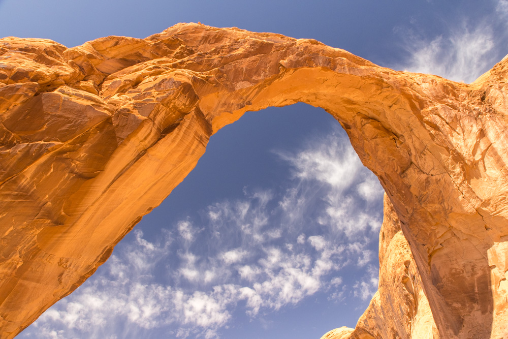
I can see how Bowtie Arch was created - but for the wind and rain carving away the sandstone to create
Corona Arch is hard to imagine. It is so graceful.
After enjoying the west side I walked under the arch to the less populated east side. Again marveling at the
grace of the arch.
From underneath the arch it is hard to understand how the rock stays up - it seems so narrow.
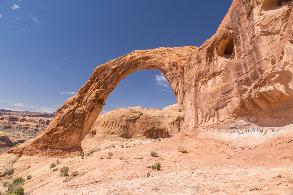
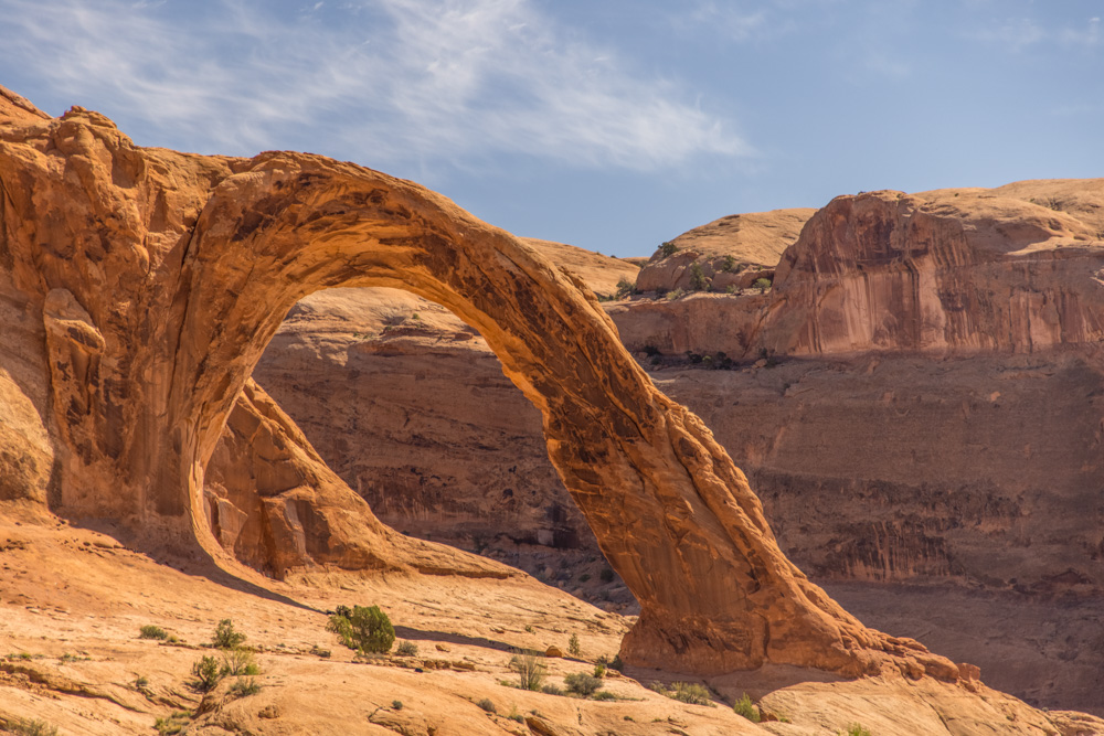
In the shade of the arch many were resting after the hike.
While under Corona Arch and looking up I saw the composition in this picture which looked like skull looking out
of the cliff face.
The hike to Corona Arch is a bit challenging but worth it - highly recommended.
On the way back to Moab I stopped on a few miles out of town to photograph the petroglyphs along Potash Road. The
petroglyphs are high on the cliff face - it is thought that the ground was higher 1000s of years ago.
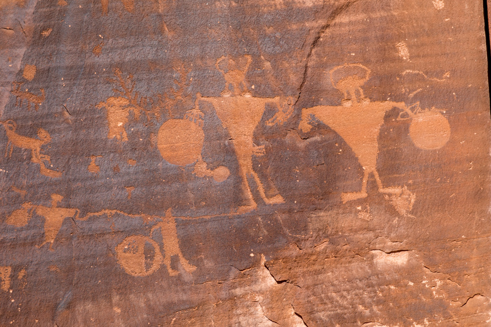
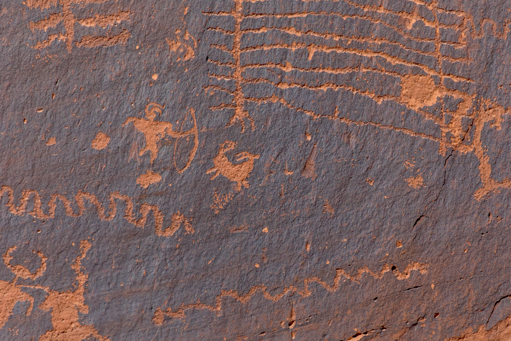
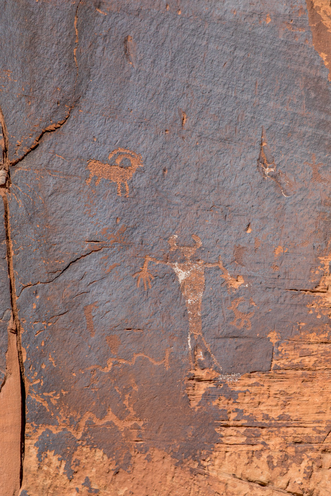
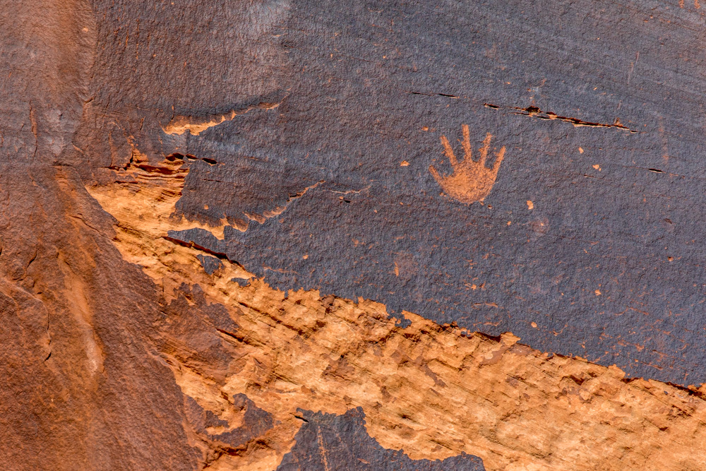
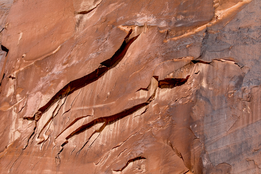
For several hundred yards the walls are decorated with all types of characters.
This is a hunting scene - I enjoyed the small human shooting at the animal. I can only imagine the pride the
person had while documenting their successful hunt.
I think the human shapes are a little odd - almost alien looking
My favorite is this simple hand on the wall off by itself.
The same section of the cliffs had several unique rock formations and textures. The dark stain on the red rock is
Desert Varnish
Rock face with deep cuts.
The cliffs rise straight up from the road - later I saw rock climbers practicing on the same cliffs - well not
near the petroglyphs.
After spending 3 hours at Corona Arch and vicinity Arches National Park was open and I headed to the Devil's
Garden. The trail is almost 8 miles and strenuous at times.
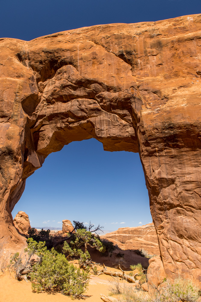
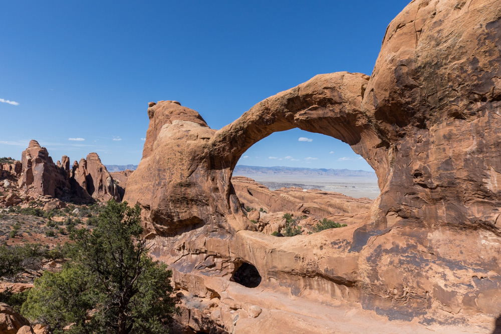
The first few arches were easy to get to just off the parking lot. This is Pine Tree Arch.
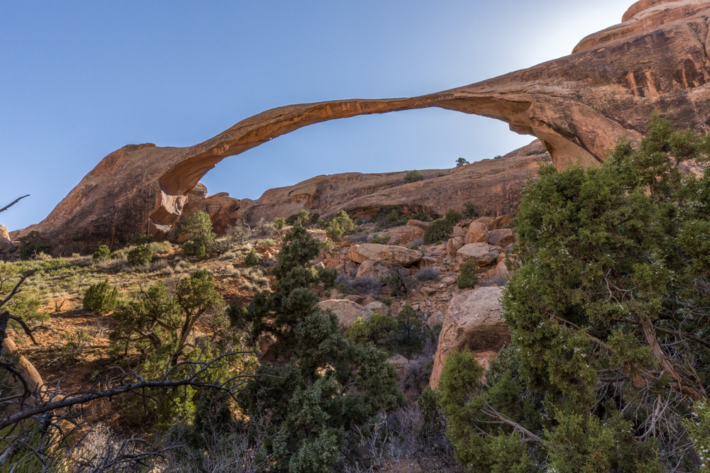
A dead tree along the Devil's Garden trail
Partition Arch is really two holes in the rock overlooking the valley to the east.
Navajo Arch is almost like a cave it is so low and long. It was hard to stop people from hiking in long enough
for me to take a picture.
Landscape Arch is beautiful - it looks so thin. Recently stones dropped from the span so you cannot hike very
close. Given its position on the hill and the sun it was challenging to get a picture.
At the end of the trail is Double O Arch named for its two openings. It is hard to see the smaller one look to
the center bottom and you see a dark opening - this is the lower arch. I climbed through the lower arch which is
a good 12 feet wide and then climbed up to the ledge where I took the picture.
The hike through Devil's Garden was hard - I was beat. Many of the trails were over rock and some were very
steep. But I make it through.
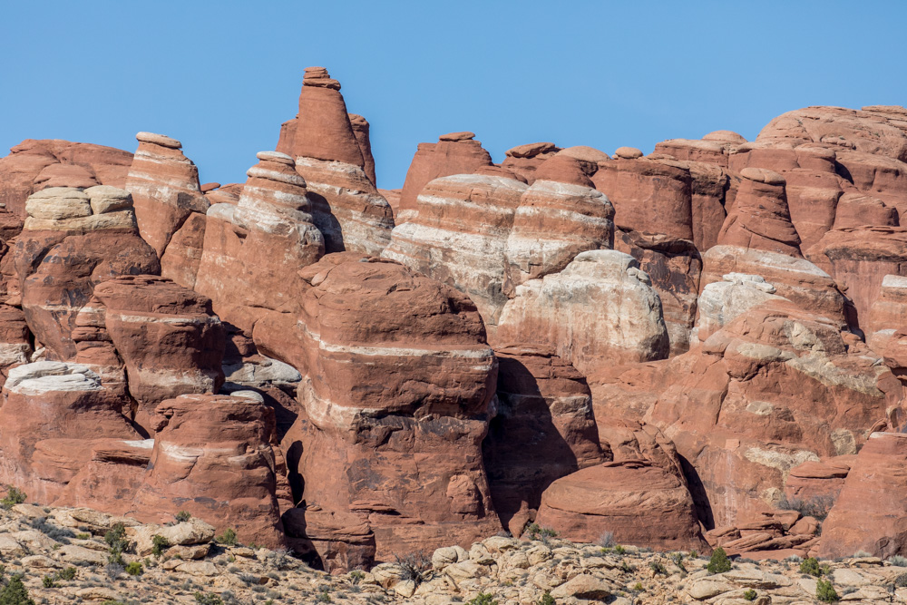
On the drive out of Devil's Garden I spotted these rocks in the distance. Pulling over and extending
the tripod I took one last short of the north side of Arches National Park and then headed to the hotel.