grandcanyon2011
Up at 0400 to grab the first bus out to Yaki Point at 0500. Coffee pot in my hotel did not work so it was a slow start. At the bus were several couples taking the bus to the trail head of South Kaibab Trail and one other photographer.
grandcanyon2011
As we got off the bus I began a race for the outcrop I scouted the day before. And the other photographer was right behind me. Fortunately, I knew where I was going and he needed a flashlight. We both were headed to the same spot - I got there first. It was large enough for both of us.

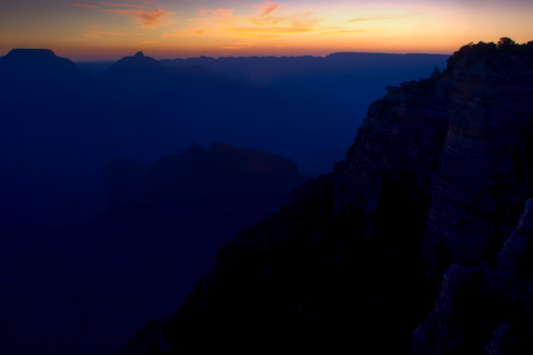
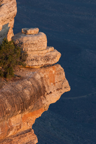
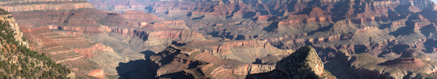
We both watched the sun crest the ridges to the east.
grandcanyon2011
The real color was to the west of Yaki Point as the sun rose.
grandcanyon2011
The sun creates a colorful painting with the yellow rock near me and the red rocks in the distance.
grandcanyon2011
Tempting little vista point - a little too hard to reach. There were several outcrops along Yaki Point - I was on one - much more solid than this one.
grandcanyon2011
The sun is higher but still deep shadows over the valley a touch of red in the background. Another good photo spot.
grandcanyon2011
A cliff high over the canyon floor below is lit by the sun. It will be another hour before the sun hits the valley.
grandcanyon2011
A red ridge line extending out from Yaki Point. This is O'Neil Butte and the South Kaibab Trail cuts diagonally across the east face.

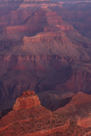
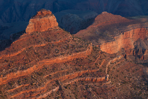
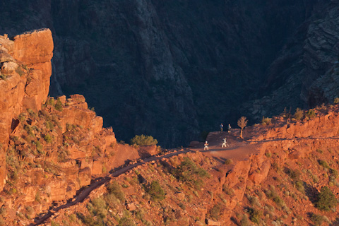
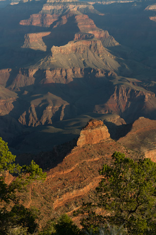
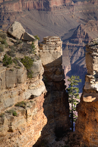
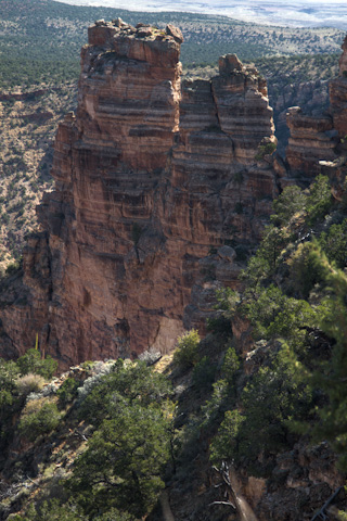
I watched this ridge for several hours as the sun rose. The red rock is so pretty but it also had a trail across the side I was on. I hoped to see the hikers dropped off on my bus earlier as they started on the South Kaibab Trail. You can make out the trail on the second hump pretty faint from here.
grandcanyon2011
Finally I spotted hikers on the trail. So tiny way below. There are two pairs here. You can see one couple clearly in white pants and shirt. There is another looking into the gorge in blue and black. It was very cool to spot them and the 100-400 lens made them visible.
grandcanyon2011
As I was hiking back to the shuttle bus stop I looked back to the spot I had occupied for over 3 hours. The woman taking the photo is standing on the rock I had just vacated. She and a friend had arrived just before I left.
grandcanyon2011
My last shot from Yaki Point - framing the O'Neil Butte from another vantage. Actually I was spending time waiting for the shuttle bus. The Shuttle bus took me back to my car and for the rest of the day I was driving.
grandcanyon2011
Now on my own driving between view points. The first stop is Grandview Point - also the trail head for Grandview Trail. As it was still early - about 1030 - several hikers were coming up the trail from the bottom!! I went down the trail several yards to see the Grand Canyon unobstructed.
grandcanyon2011
Grandview Point lived up to it's name - beautiful vistas. I am attracted to the cliffs in the foreground.
grandcanyon2011
Ridges leading down to the river are in shade with the North Rim bathed in sunlight. At 7,406 feet Grandview is one of the highest points on the South Rim. There are tall ponderosa pines all about.
grandcanyon2011
The next stop is Moran Point - a great photo stop with nice compositions in any direction. I really liked this stone ridge against the red walls of the North Rim.

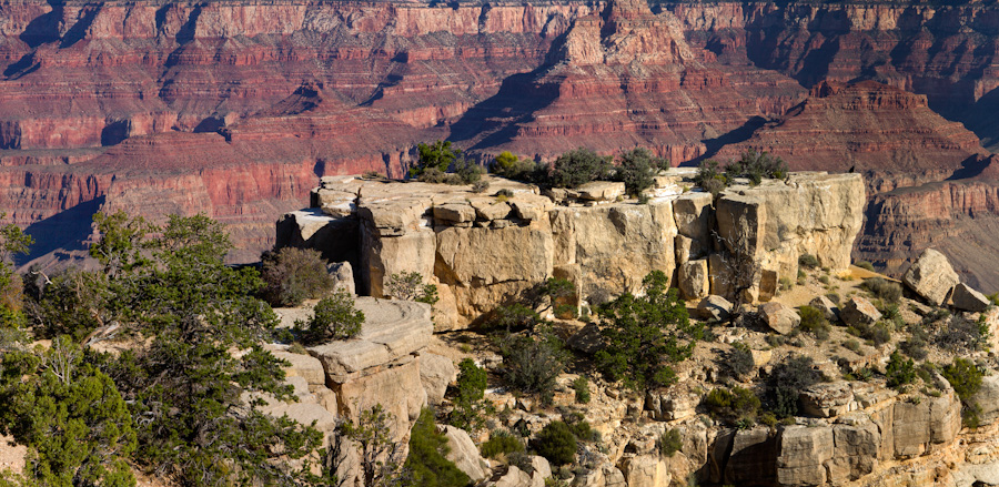
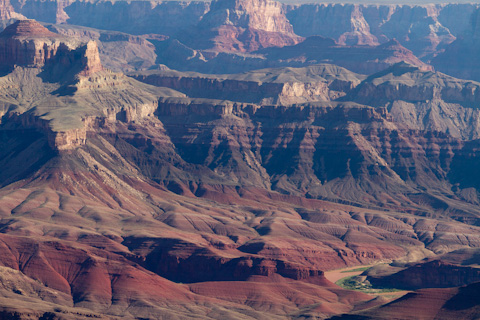
This view point is named after the landscape painter Thomas Moran who came here for the first time in 1873.
grandcanyon2011
There is a unique cliff at Moran Point looking east. There is a neat tree growing between the rock formations. Unfortunately the light was just not good enough to show off the tree.
grandcanyon2011
Unkar Delta from Moran Point with a long lens. Unkar is a Paiute word for 'red stone' and the delta is surrounded by vibrant red rocks. The sandy banks were formed by rock debris that Unkar Creek swept down from the North Rim during floods.
grandcanyon2011
The cliffs at Moran Point with the Colorado River in the distance. You can understand why the painters were attracted to the Grand Canyon.
grandcanyon2011
Unkar Delta from Lipan Point. Several miles from Moran point now the Colorado River is much closer. The next photo is a zoom of Hance Rapid near the shadowed cliffs.
grandcanyon2011
Zooming in on Hence Rapid there is a 20-person raft just entering the choppy water.


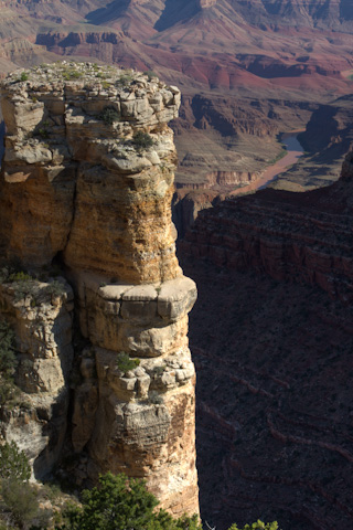
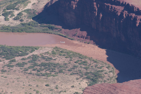
From here it is on to Lipan Point.
grandcanyon2011
Looking west from Lipan Point are some impressive cliffs. This is one of my favorite cliffs. I was in the Grand Canyon several years ago and took one of my best shots of this cliff in winter.
grandcanyon2011
The intrepid photographer - Cal Holman at Lipan Point shooting into the Grand Canyon. This was taken by a German tourist who, along with his girlfriend, were leap frogging to each view on the same pattern as me. We kept saying 'hi' at each view point and I asked him to take my picture at Lipham Point.
grandcanyon2011
A quick stop at Navajo Point resulted in this panorama. Navajo Point is close to Desert View so I stopped and made a quick panorama.
grandcanyon2011
The Colorado River from the last point on the eastern drive - Desert View. You can see quite a bit of the Colorado River as it emerges from Marble Canyon and heads into the Grand Canyon.
grandcanyon2011
A rock formation on the east of Desert View. The desert behind the rock is the plateau leading to the Grand Canyon.

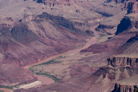
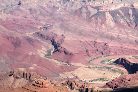
There is a watchtower at Desert View which makes a good platform for panoramas of the Grand Canyon. It is very touristy.
grandcanyon2011
The Colorado River behind a small rock formation below Desert View.

From here I headed back to Phoenix - my 24 hours up about noon on the 18th. A great visit - over 1000 pictures and a great time.

For larger versions of the photos you can visit the scrapbook: Grand Canyon in the Scrapbook .


Top
Top